Point
An urgent investigation related to the April 2016 Kumamoto earthquakes was conducted in order to record surface ruptures and to clarify site amplification characteristics severely damaged town of Mashiki.
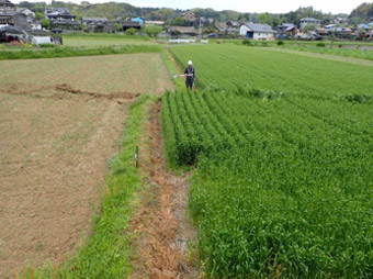 |
| Surface ruptures from the Futagawa fault zone |
Result and Method
An urgent field survey was conducted immediately after the 2016 Kumamoto earthquakes, with the purpose of recording surface rupture of the earthquake. It was found that surface ruptures emerged about 28 km long along the Futagawa fault zone, and about 6 km long along the northern end of the Hinagu fault zone. Survey results such as surface rupture distribution, displacement, and ground deformation features, were quickly published online and were also used for an earthquake evaluation by the government of Japan. After the urgent field survey, surveys about ground amplification characteristics and about rupture history of Hinagu fault zone were conducted for the risk evaluation of a major earthquake; that information too, was promptly published.
Background
Geological surveys about natural hazards especially about earthquakes and volcanic eruptions have been conducted by GSJ in order to reduce disaster risk of our society. Urgent surveys of large earthquakes have been conducted immediately after the events. Results of the surveys also have been published promptly including surface ruptures and site amplification characteristics of the affected area(s) on the Internet as well as on the “Active Fault Database of Japan” and “GeomapNavi”.
Plan for the Future
These data will be used in the official evaluation of the Kumamoto earthquakes by The Headquarters for Earthquake Research Promotion of the government. In addition, they will be used as basic data for variety of efforts such as investigative researches and restoration works.
Contact
 |
|
 |
|
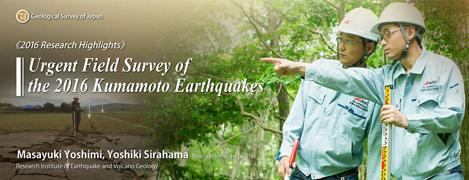
Research Institute of Earthquake and Volcano Geology
Masayuki Yoshimi, Senior Researcher, Earthquake Hazard Assessment Research Group (left), Yoshiki Shirahama, Researcher, Active Fault Research Group (right)
AIST Tsukuba Central 7 1-1-1 Higashi, Tsukuba, Ibaraki 305-8567 Japan
TEL: +81-29-861-3691
Email: ievg-webmaster-ml*aist.go.jp (Please convert "*" to "@".)
|